From Bruce Reisch
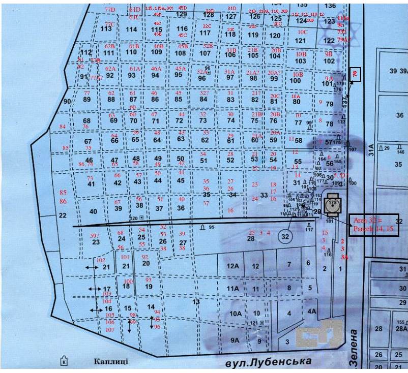
This image represents how I currently
think the old "Parcels" correspond to the new "Areas". The
"Areas" are on the original map, in black print, and I've inserted the
"Parcel" numbers in red. Question marks indicate some degree of either
uncertainty or a possible inference about a parcel number in the
absence of good information. There are errors in this, I am sure,
but it's the best I can do at the moment. It represents the
information I gathered from looking at lots of tombstone photos that
are already grouped by Area and finding the corresponding entry in the
old burial registry. That entry leads me to the old Parcel numbers, and
produces information on the correspondence between Areas (new
system) and Parcels (old system).
If you visit Czernowitz and find a map of this type that is being used by locals to locate tombstones using old Parcel numbers, please photocopy it, or photograph it, and bring it back for posting on this web site.
Bruce Reisch <bir1_at_nysaes.cornell.edu>
If you visit Czernowitz and find a map of this type that is being used by locals to locate tombstones using old Parcel numbers, please photocopy it, or photograph it, and bring it back for posting on this web site.
Bruce Reisch <bir1_at_nysaes.cornell.edu>